

Photos
![[Download]](../skins/arkologik/images/results/download_sml.png "Download")
Description
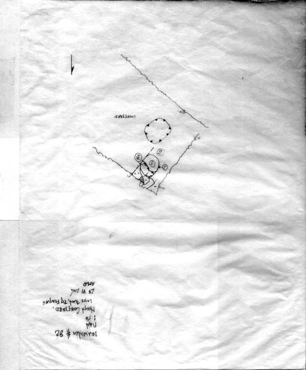
- North Courtyard, Layer Plan, Pit Feature
Scale

Linked Contexts
-
Context: CH06SR_763
- Distinct cut parallel to wall 265 [and wall 50] that cut through the pit (Context 770) down to the bedrock. Bottom was gently sloping with fairly straight walls in the profile of section 1. The cut was approximately 65 cm (NE-SW) towards the bottom and 3.6 M along walls 50 and 65.
-
Context: CH06SR_770
- Dimensions of pit are 84 cm (NW-SE) X 97 cm (NE-SW) [63 cm to the wall trench 762] and 55 cm in depth. Dark brown fill of soil with little clay. The pit was constructed by a well-formed circular cut into the bedrock. The sides are slightly steep with a rounded bottom.
-
Context: CH06SR_771
- Cut with fairly steep edges and a rounded bottom. At surface the dimensions are 90 cm (N-S) X 95 cm (E-W) and the depth is 55 cm from the surface of bedrock/slab? The south and west surface of the cut is higher than the north and (even higher than that from the) east.
-
Context: CH06SR_772
- A very compact yellowish brown soil that occurs on both sides of the slab (773). To the east of the slab the dimensions are 57 cm (NE-SW) X 44cm (NW-SE). To the west of the slab the dimensions are 55 cm (NE-SW) X 81 cm (NW-SE). After removing 0774 it was determined that 0772 extended across the entire area between 0773 and wall296/297. The yellow is due to clay inclusions. The dimensions to the east of the slab [0773] also increased; see context extent and sketch plan.
GIS Status

Events
-
Illustrator
Drawn On
28-6-2006