

PhotoModeler Projects

![[Download]](../skins/arkologik/images/results/download_sml.png "Download")
Description
- 1 and 2 sections
Linked Contexts
-
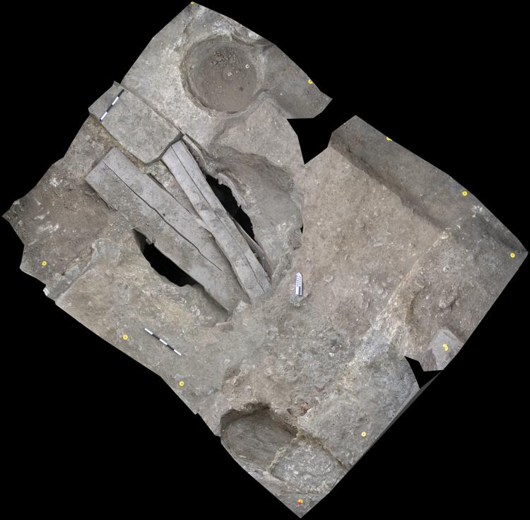
Context: CH06SR_772
- A very compact yellowish brown soil that occurs on both sides of the slab (773). To the east of the slab the dimensions are 57 cm (NE-SW) X 44cm (NW-SE). To the west of the slab the dimensions are 55 cm (NE-SW) X 81 cm (NW-SE). After removing 0774 it was determined that 0772 extended across the entire area between 0773 and wall296/297. The yellow is due to clay inclusions. The dimensions to the east of the slab [0773] also increased; see context extent and sketch plan.
-
Context: CH06SR_817
- The cut is 84 cm (NW-SE) X 60 cm (NE-SW) then narrowing to 30 cm (NE-SW) as it approaches section 2. The sides vary, 2 are steep and the other gently sloping. The Northeastern most edge abuts pit 0823. The cut is approximately 30 cm in depth and the bottom and edges look like eroded bedrock.
-
Context: CH06SR_822
- The cut is approximately 70 cm (NW-SE) X (NE-SW) and approximately 35-40 cm in depth with steep edges and a relatively flat bottom. The cut appears to extend under wall 296. One edge is a sharp/steep cut of bedrock, the other two edges are into soil (both into what may be a trench dug to rob stone slabs).
-
Context: CH06SR_837
- A dark brown clayey soil with medium sized (10-20 cm in diameter) stones. The dimensions are approximately 80 cm (NW-SE) and 3.6 M (E-SW), running from wall 296 to the wall trench 0762. The context/cut is perpendicular to walls 296 and 50. Artifacts including tile, ceramics and bone were prevelant throughout context, but especially concentrated near wall 0296.
Events
-
Photographed By
GK -
Modeler
- JT