

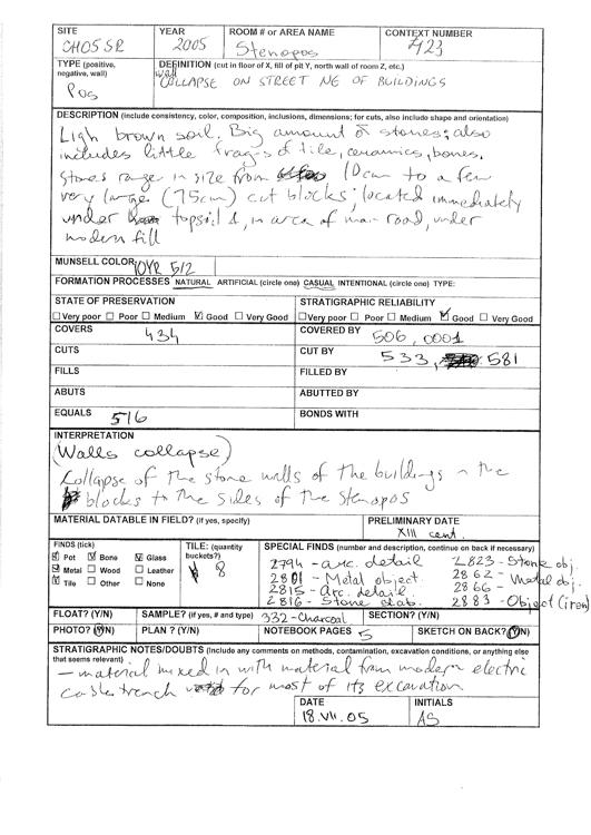
Description
- CH05SR0423
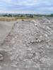
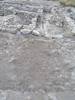
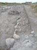
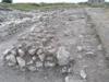
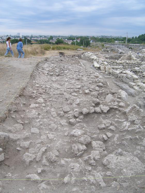
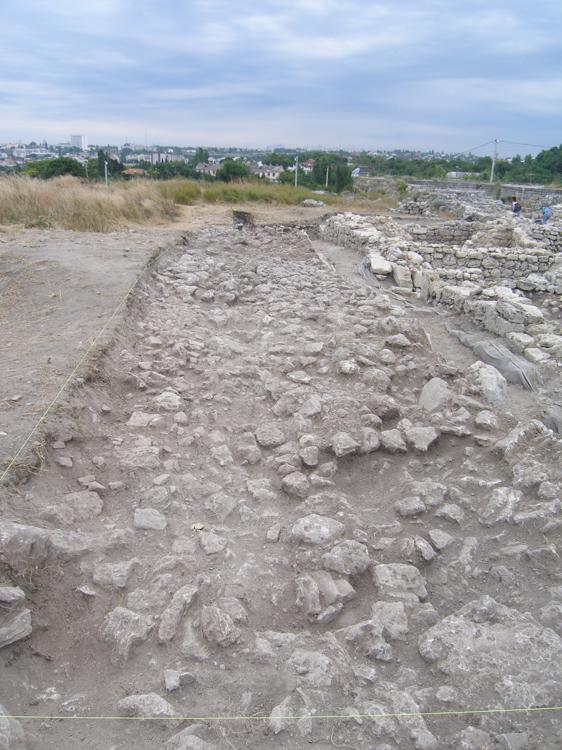
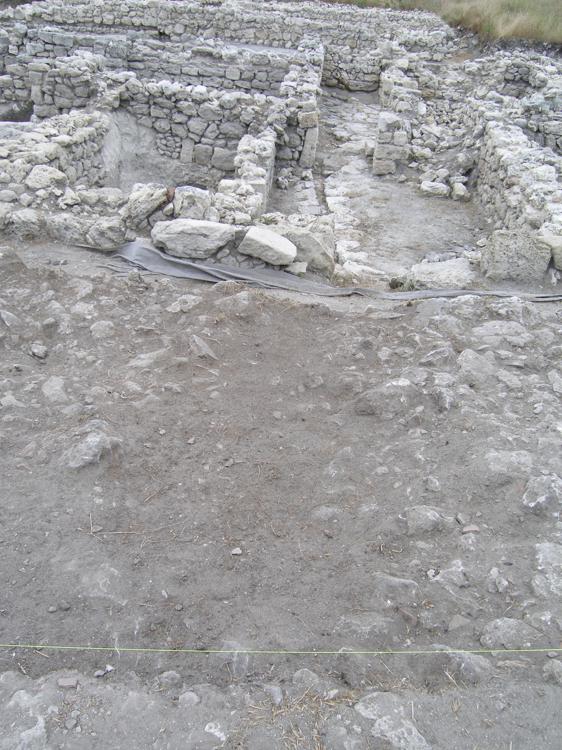
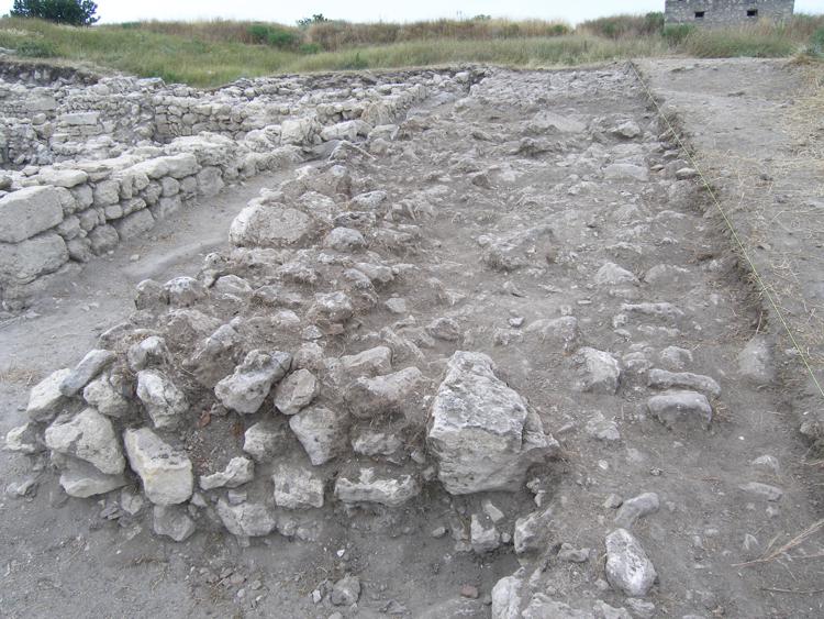
- Collapse on street NE of buildings
- Light brown-grey soil with big amount of stones; also includes small frag-s of tile, ceramics; bones. Stones range in size from 10 cm to a few very large (75 cm) cut blocks; located immediately under topsoil and in area of main road - under modern fill. See also CH04SR0423.
- Material mixed in with material from modern electric cable trench for most of its excavation

Matrix
-
-
CH05SR_506
Covers
-
CH05SR_533
Cuts
-
CH05SR_581
Cuts
-
CH05SR_506
-
-
Covers
CH04SR_434 -
Covers
CH05SR_434 -
Covers
CH05SR_510
-
-
Same As
None linked.
Interpretation
-
- collapse of the stone walls of the buildings in the blocks to the sides of the stenopos
-
- AS
Formation Processes
Faunal Assemblage
- There are no results for this record
Fish Species Assemblage
Total = 3
| Total | |
|---|---|
| Sander lucioperca | 1 |
| Raja clavata | 2 |
Birds Species Assemblage
- There are no results for this record
Ceramic Assemblage
Total = 73
| Total | |
|---|---|
| Pithos | 2 |
| Amphora | 38 |
| Cookware | 4 |
| Fineware | 29 |
Total = 73
| Total | |
|---|---|
| Pithos (type) | 2 |
| Class 1 | 3 |
| Class 3 (Zeest-100) | 5 |
| ADSV, type V | 2 |
| Class 12 (LRC 1-Riley) | 1 |
| Class 22 (Zeest-95; LRA 3-Riley) | 2 |
| Class 24 ("Black Sea" with rilled zones) | 7 |
| Class 43 (Gunsenin-II) ("collared") | 1 |
| Class 45 (Gunsenin-IV) | 9 |
| Class 48 (Gunsenin-III) | 1 |
| Class 52 | 5 |
| Unidentified amphora | 2 |
| Wheelmade cookware | 4 |
| Unidentified plain fineware | 8 |
| Glazed White Ware II | 1 |
| Glazed White Ware IV (group 9, Yakobson) | 3 |
| Aegean ware (group 3, Yakobson) | 1 |
| Champleve ware (Group 4, Yakobson) | 1 |
| Sgraffito ware (monochrome) | 12 |
| Red-slip | 1 |
| ARSW, form 105 | 1 |
| Black gloss | 1 |
Total = 73
| Total | |
|---|---|
| 5th-7th c. AD | 13 |
| 9th-11th c. AD | 9 |
| 12th-13th c. AD | 20 |
| 13th c. AD | 12 |
| Roman (Ceramic date) | 1 |
| second half of 6th-first half of 7th c. AD | 1 |
| Hellenistic (Ceramic date) | 1 |
Linked Special Finds
-
Special Find: CH05SR_2794
- Architectural detail
-
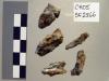
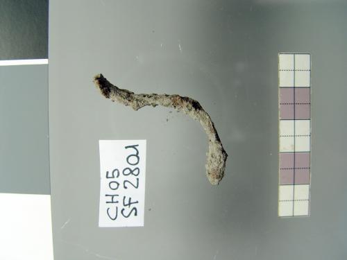
Special Find: CH05SR_2801
- Object
-
-
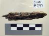
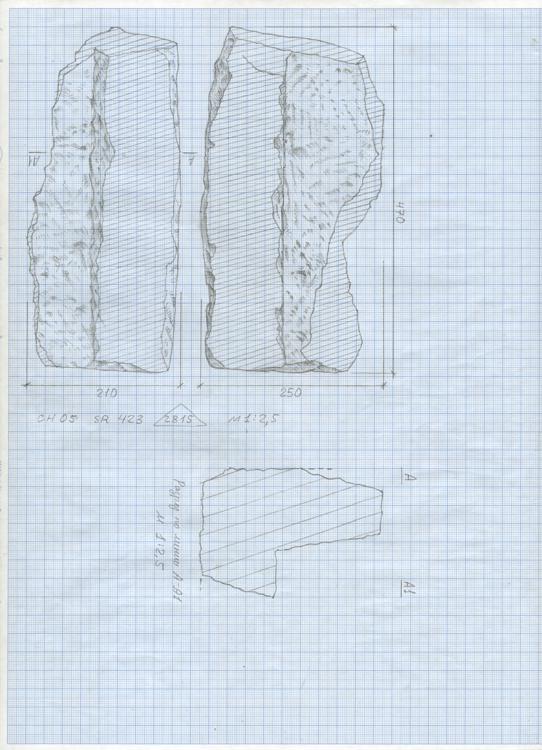
Special Find: CH05SR_2815
- Architectural detail
-
-
Special Find: CH05SR_2816
- Stone slab
-
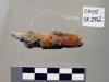
Special Find: CH05SR_2823
- Fragmentarily preserved grindstone
-
-
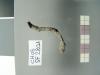
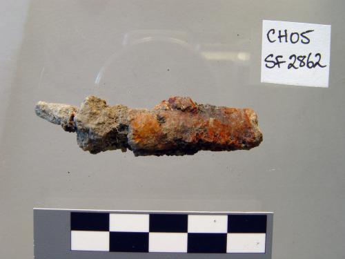
Special Find: CH05SR_2862
- Object
-
-
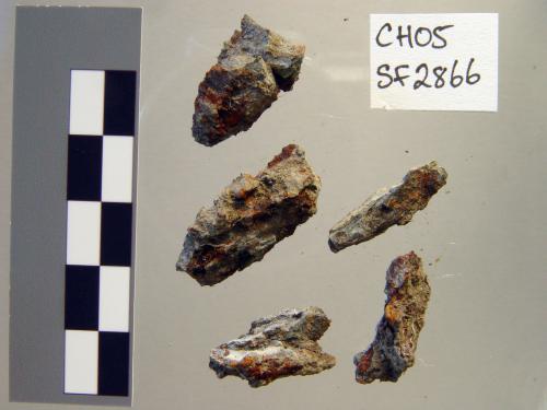
Special Find: CH05SR_2866
- Object
-
-
Special Find: CH05SR_2883
- Object
-


Linked Samples
-
Sample: CH05SR_332
- Charcoal sample from stenopos
Botanical Assemblage
Skeletal Remains
- No attached items.
Microwear Analysis
-
Microwear Record: CH05SR_P33
- Pig
Recording Sheet
![[Download]](../skins/arkologik/images/results/download_sml.png "Download")
Record Status Flags

Events
-
Excavator
- ATR
Date Excavated
1-8-2005 -
Verified by
ATRVerified on
17-7-2006 -
Entered By
- AS
Site Photos
-
Site Photo: CH05SR_433
-
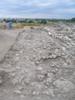
- Layer of collapse in east extension
-
-
Site Photo: CH05SR_434
-
- Layer of collapse in east extension
-
-
Site Photo: CH05SR_435
-
- Trace of modern disturbance
-
-
Site Photo: CH05SR_436
-
- Layer of collapse, south end where meeting main street
-
-
Site Photo: CH05SR_437
-
- Layer of colapse - southern part
-

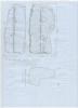
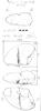
Sketches

![[Download]](http://web.corral.tacc.utexas.edu/ICA/ChersonesosSouth/ChersonesosSouth_ARK/image_documentation/excavation/sketches/skt_CH05SR_0423_m.jpg "Download")
Linked GeoPhotos
-
Geophoto: CH05SR_120
- collapse of street NE of buildings
-
Geophoto: CH05SR_121
- collapse of street NE of buildings
-
Geophoto: CH05SR_122
- collapse of street NE of buildings
-
Geophoto: CH05SR_123
- collapse of street NE of buildings
-
Geophoto: CH05SR_124
- collapse of street NE of buildings
-
Geophoto: CH05SR_125
- collapse of street NE of buildings
-
Geophoto: CH05SR_126
- collapse of street NE of buildings
-
Geophoto: CH05SR_127
- collapse of street NE of buildings
-
Geophoto: CH05SR_128
- collapse of street NE of buildings
-
Geophoto: CH05SR_129
- collapse of street NE of buildings
-
Geophoto: CH05SR_130
- collapse of street NE of buildings
-
Geophoto: CH05SR_131
- collapse of street NE of buildings
-
Geophoto: CH05SR_132
- collapse of street NE of buildings
-
Geophoto: CH05SR_133
- collapse of street NE of buildings
-
Geophoto: CH05SR_134
- collapse of street NE of buildings
-
Geophoto: CH05SR_135
- collapse of street NE of buildings
-
Geophoto: CH05SR_136
- collapse of street NE of buildings
-
Geophoto: CH05SR_137
- collapse of street NE of buildings
-
Geophoto: CH05SR_138
- collapse of street NE of buildings
-
Geophoto: CH05SR_139
- collapse of street NE of buildings
-
Geophoto: CH05SR_140
- collapse of street NE of buildings
-
Geophoto: CH05SR_141
- collapse of street NE of buildings
-
Geophoto: CH05SR_142
- collapse of street NE of buildings
-
Geophoto: CH05SR_143
- collapse of street NE of buildings
-
Geophoto: CH05SR_144
- collapse of street NE of buildings
-
Geophoto: CH05SR_145
- collapse of street NE of buildings
-
Geophoto: CH05SR_146
- collapse of street NE of buildings
-
Geophoto: CH05SR_148
- collapse of street NE of buildings
-
Geophoto: CH05SR_149
- collapse of street NE of buildings
-
Geophoto: CH05SR_150
- collapse of street NE of buildings
-
Geophoto: CH05SR_151
- collapse of street NE of buildings
-
Geophoto: CH05SR_152
- collapse of street NE of buildings
-
Geophoto: CH05SR_153
- collapse of street NE of buildings
-
Geophoto: CH05SR_154
- collapse of street NE of buildings
-
Geophoto: CH05SR_155
- collapse of street NE of buildings
-
Geophoto: CH05SR_156
- collapse of street NE of buildings
-
Geophoto: CH05SR_157
- collapse on street NE of buildings
-
Geophoto: CH05SR_158
- collapse on street NE of buildings
-
Geophoto: CH05SR_159
- collapse in street NE of buildings
-
Geophoto: CH05SR_160
- collapse on street NE of buildings
-
Geophoto: CH05SR_161
- collapse in street NE of buildings
-
Geophoto: CH05SR_162
- collapse in street NE of buildings
-
Geophoto: CH05SR_163
- collapse in street NE of buildings
-
Geophoto: CH05SR_164
- collapse in street NE of buildings
-
Geophoto: CH05SR_165
- collapse in street NE of buildings
Linked Drawings
- No attached items.
Linked TopoSurfaces
-
Topo Surface: CH05SR_7
- Rubble layer in Stenopos
PhotoModeler Projects
- No attached items.